As an Amazon Associate, we earn from qualifying purchases. Some links on this site are affiliate links at no extra cost to you. Our recommendations are based on thorough research and editorial judgment.
What Is the Benefit of Barometric Altimeters in Bike Computers?
Barometric altimeters in bike computers provide accurate elevation measurements through atmospheric pressure changes. This precision is essential, especially in variable terrains like mountains. Their ability to deliver real-time altitude data enhances our awareness during rides, aiding in energy conservation. Regular calibration helps maintain accuracy despite environmental factors. Additionally, integrating these altimeters with GPS increases reliability and mitigates sensor drift. By understanding their benefits, we can better track performance metrics and improve our cycling experience.
Key Takeaways
- Barometric altimeters provide immediate altitude data by measuring atmospheric pressure changes, offering precise elevation tracking during rides.
- Regular calibration against known elevation points enhances accuracy, making barometric readings more reliable than GPS alone.
- They excel in short- to medium-range performance, maintaining high sensitivity while bypassing the satellite signal dependency of GPS systems.
- Integrated data from barometric altimeters improves overall cycling performance analysis, especially for mountain biking and hill walking.
- Accurate elevation measurements facilitate effective energy conservation strategies and enhance training metrics through detailed elevation change tracking.
Understanding Barometric Altimeters
You may be interested


In many bike computers, barometric altimeters play an essential role in measuring altitude changes. Using barometric principles, these devices measure atmospheric pressure variations to determine shifts in elevation. As we ascend, air pressure decreases exponentially, allowing the altimeter to infer our altitude.
To calculate elevation gain or loss, the altimeter integrates pressure changes over time. It works best in stable weather conditions where pressure reflects true altitude shifts. Regular calibration is vital, often using known altitude points or GPS data for accuracy. Additionally, many modern cycling computers, like the Garmin Edge 530, feature advanced navigation capabilities that enhance the overall riding experience.
Accuracy of Elevation Measurement

Barometric altimeters play a critical role in ensuring accurate elevation measurements during cycling. These devices gauge air pressure, allowing for an elevation accuracy that’s generally around 10 feet under stable conditions. However, environmental factors such as temperature and pressure changes can affect barometric performance.
To improve our readings, recalibration is essential. We can manually input known elevation points or utilize GPS at the start of our ride. Some systems even adjust during rides by comparing barometric data against GPS.
Despite potential errors, like drift from weather fluctuations, well-calibrated barometric altimeters typically provide more reliable data than GPS alone. They markedly reduce measurement noise, making them valuable for tracking elevation gain and loss in variable terrains, ensuring better reliability overall. Additionally, devices with high waterproof ratings are crucial for maintaining performance in challenging weather conditions.
Comparisons With GPS Altimeters

When comparing altimeter technologies, GPS altimeters come to the forefront alongside barometric alternatives.
Response Time
Barometric altimeters deliver immediate altitude data based on air pressure shifts, while GPS altimeters depend on satellite signals. This dependence introduces delays, especially in areas with poor reception, like forests or urban canyons.
Accuracy
Barometric benefits manifest in consistent short- to medium-range performance. In contrast, GPS limitations arise from accumulated errors over distance due to less precise vertical triangulation.
Power Efficiency
Barometric sensors consume less power, extending battery life compared to GPS systems, which can drain batteries with continuous signal processing. Additionally, safety certifications for bike helmets highlight the importance of reliable technology in various outdoor activities.
Recommended Products

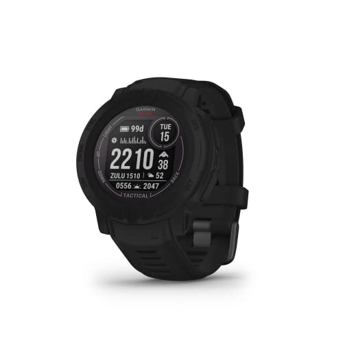
Advanced tactical GPS smartwatch features a 1.4” solar charged display, titanium bezel and sapphire lens and built-in LED flashlight for after-dark visibility

Premium full-featured dive computer with surface GPS in a sleek watch-style design; with bright 1. 2” color display and TOPO mapping
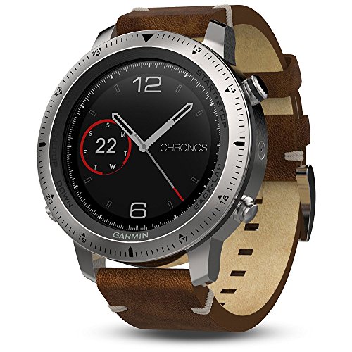
Premium multisport watch with durable stainless steel housing, a high-strength, scratch-resistant sapphire lens and a premium leather band
Calibration Needs for Barometric Altimeters

Calibration is essential for guaranteeing accurate readings from barometric altimeters in bike computers. Regular barometric calibration is necessary due to frequent air pressure changes caused by environmental factors. We should perform manual calibration at known elevations for ideal accuracy. This method often yields better results than relying solely on GPS data.
It’s imperative to recalibrate whenever we experience sudden shifts in temperature or humidity, as these can impact sensor performance. Sensor maintenance is also crucial; clogged ports can impair pressure detection.
To maintain accuracy, we recommend periodic recalibration during rides, especially when facing significant elevation changes or weather fluctuations. Establishing a calibration routine will guarantee our ride data remains reliable and precise, enhancing our performance analysis. Additionally, many cycling computers offer dynamic tracking capabilities which can assist in monitoring elevation changes more effectively.
Reliability in Variable Terrain
Understanding the reliability of altitude measurements in variable terrain is essential for any cyclist. Barometric altimeters excel in measuring elevation changes due to their high barometric sensitivity. They provide stable readings, which is crucial in areas with frequent terrain shifts.
- Consistent Tracking: Unlike GPS altitudes, barometric sensors closely follow pressure changes, ensuring accurate elevation data with smaller error margins.
- Reduced Signal Dependency: Barometric altimeters don’t rely on satellite signals, avoiding issues like signal loss in valleys or forests.
- Improved Accuracy: They deliver superior elevation gain information by directly detecting pressure-induced changes, avoiding inaccuracies that come with GPS fluctuations. Additionally, regular maintenance of bike components, such as brake fluid compatibility, ensures overall performance and reliability during rides.
The Role of Weather in Altitude Accuracy
The relationship between weather conditions and altitude accuracy is essential for cyclists relying on barometric altimeters. Atmospheric pressure directly influences altitude readings. Weather fluctuations can cause ambient air pressure to drop, resulting in falsely high elevation gain readings. Alternatively, rising air pressure from improving weather can underestimate elevation gain.
These inaccuracies arise because barometric altimeters assume stable pressure during rides; however, weather changes often disrupt this assumption. Rapid shifts in temperature or humidity, such as moving from air conditioning outdoors, can instantly drift an altimeter’s readings. To mitigate these errors, we should wait for a strong GPS signal at the ride’s start and consider combining GPS data with barometric readings for the most reliable altitude information, ensuring accuracy on our journeys. Additionally, utilizing models with advanced navigation features can significantly enhance tracking reliability during variable weather conditions.
Enhanced Training and Performance Insights
Enhanced training and performance insights are essential for cyclists aiming to maximize their capabilities. Barometric altimeters provide precise elevation tracking, allowing us to quantify our training load effectively. This accurate elevation data helps us plan climbing-specific workouts to target our elevation goals while monitoring fatigue.
Moreover, real-time elevation graphs show gradients, enabling better pacing during climbs. We can structure our training around elevation targets, focusing on specific power outputs essential for steep ascents. The integration of accurate altitude metrics into our bike computers enhances our understanding of ride segments and recovery needs. By reducing measurement errors, barometric altimeters offer reliable data for analyzing our performance and adjusting our training strategies, ultimately leading to improved climbing endurance and efficiency. Additionally, incorporating insights from power meter accuracy can further refine our training approaches for optimal results.
Recommended Products

Multisport GPS watch with solar charging capabilities uses a Power Glass solar charging lens and custom power manager modes to achieve long-lasting battery life

Solar Powered Multisport GPS Watch with large 1.4 inches display (36% larger than previous fenix models) uses the sun’s energy to extend battery life and assure more on-wrist time for your off-grid activities

Rugged GPS watch built to withstand the toughest environments
Power Efficiency in Long Rides
When we go on long rides, optimizing power efficiency becomes vital for maximizing our time on the bike. Barometric altimeters play an important role in this. By using pressure sensors instead of constant GPS, we greatly cut down battery consumption. This means we can achieve longer endurance on our rides. With barometric sensors ensuring continuous altitude readings, the need for GPS activation is reduced.
- Extended battery life ranges from 15 to 40 hours depend on usage.
- Some models even incorporate solar charging for efficient charging while we ride. Additionally, the use of high pressure capacity in bike pumps can also enhance overall ride efficiency by ensuring optimal tire inflation.
Data Consistency Over Time
Understanding data consistency over time is crucial for accurate elevation readings during our rides. When combined with GPS, barometric altimeters help mitigate sensor drift, which can cause data inaccuracies. Environmental factors like temperature and humidity also impact barometric readings, leading to inconsistencies if not corrected with GPS inputs.
To enhance data consistency, we should consider the following:
- Elevation Smoothing: Smoothing algorithms reduce noise and enhance accuracy in elevation data.
- Data Logging Frequency: Higher frequencies capture more changes but may introduce noise; balancing this is critical.
- Regular Maintenance: Keeping our barometric sensor ports clean guarantees consistent readings. Additionally, using multi-sensor inputs can further improve accuracy by providing complementary data that enhances overall performance.
Integration With Advanced Sensor Systems
Bike computers equipped with barometric altimeters provide significant advantages when integrated with advanced sensor systems. This sensor integration enables enhanced performance monitoring by combining altitude data with metrics from heart rate monitors, cadence sensors, and power meters.
- Accurate Metrics: The fusion of pressure-based altitude readings with speed and cadence improves training analytics.
- Real-Time Adjustments: Constant air pressure measurements allow for real-time elevation updates, vital for navigation and pacing.
- Dynamic Calibration: Integration with GPS helps minimize drift errors in altitude data, ensuring high accuracy over long rides.
- Environmental Adaptability: Barrel adjustments based on temperature and pressure fluctuations further enhance reliability during varying conditions.
- Enhanced Performance: The combination of accurate altitude data with high-strength aluminum alloys in bike components ensures a lightweight and durable setup that can withstand rigorous rides.
Together, these features create a thorough view of cycling performance, essential for optimizing our rides.
Complementary Use With GPS Technology
While combining barometric altimeters with GPS technology, we see a significant enhancement in altitude accuracy and data reliability, vital for cyclists.
Accurate Elevation Measurement
Barometric altimeters track altitude through pressure changes, offering precise elevation data under stable weather conditions. In contrast, GPS provides a broader positional fix but can be limited to about 20-25 meters of accuracy.
Effective Calibration
Barometric calibration guarantees that the altitude readings adjust with fluctuating atmospheric pressure. This integration allows devices to refine altitude tracking, enhancing the reliability of elevation gain and loss figures.
Combined Data Benefits
Using both systems means continuous pressure readings from barometric sensors can correct GPS-derived data. This synergy improves cycle performance metrics, aiding in route planning and endurance management, guaranteeing we have the detailed information we need on our rides.
Importance for Mountain Biking and Hill Walking
When it comes to mountain biking and hill walking, having accurate elevation measurements can greatly enhance our outdoor experiences. Barometric altimeters provide precise elevation gain/loss readings, which are vital for making real-time decisions during climbs. Unlike GPS, these altimeters offer stable elevation profiles that aren’t affected by signal issues in layered terrain.
Moreover, real-time data enhances our terrain awareness. We can gauge our position against mountain passes and summits, allowing us to strategize energy conservation. Reliable altitude data also helps when steering off-trail, correlating our altitude with topographic maps. Consequently, having a barometric altimeter equips us with essential information to tackle various trails effectively and safely, ensuring we make informed choices throughout our adventures.
Recommended Products

PRELOADED GEOCACHES - 250,000 preloaded worldwide geocaches from Geocaching.com

SEE YOUR SURROUNDINGS - Includes a 1-year Birdseye Satellite Imagery subscription1. Display type : Bright, transflective 65k color TFT, dual-orientation touchscreen; sunlight readable

Ultimate multisport GPS watch with full color Topo U.S. mapping, routable cycling maps and other outdoor navigation features
Impact on Energy Expenditure Tracking
The impact of barometric altimeters on energy expenditure tracking is significant due to their enhanced accuracy in measuring elevation changes. By providing precise elevation gain and loss data, these devices improve our energy cost calculations during rides. Accurate altitude measurements allow us to recognize the vertical effort needed, which contributes to understanding total rider exertion.
- Enhanced elevation data fosters better ride optimization.
- It facilitates accurate differentiation between different terrain types, such as flat and climbing segments.
- This data improves training metrics by refining the correlation between power output and elevation change.
Applications in Competitive Cycling
Barometric altimeters are invaluable tools for competitive cyclists, offering applications that greatly enhance performance during races.
Altitude Adjustments
Real-time altitude data allows us to make precise power output adjustments. As we climb, oxygen levels decrease, which can reduce our functional threshold power (FTP). Knowing our altitude helps us avoid early fatigue and optimize effort.
Tactical Pacing
Accurate altitude information informs our climbing and descending strategies. By understanding gradient changes, we can manage energy on different slopes. This data supports strategic decision-making, like when to launch an attack or conserve energy.
Recommended Products
Go longer than ever with solar charging that gives you unlimited battery life in smartwatch mode (assuming all-day wear with 3 hours per day outside in 50,000 lux conditions)...
Choosing the Right Bike Computer
Choosing the right bike computer involves understanding our specific needs and evaluating the features that will best support our cycling goals. We’re looking for devices that offer barometric altimeters, as their accuracy in elevation data is invaluable, especially for training and route planning.
Custom Features
When selecting a device, consider those with customizable settings. This allows us to tailor metrics based on our riding style.
Device Selection
Prioritize computers that integrate sensors like cadence and heart rate monitors. Compatibility with fitness apps enhances our data analysis and performance tracking.
Frequently Asked Questions
How Do Barometric Altimeters Affect Cycling Performance Analysis?
Like a finely tuned instrument, barometric altimeters enhance our performance metrics by providing precise data accuracy. They allow us to assess elevation changes effectively, ensuring our analysis reflects true cycling efforts and oxygen dynamics in variable terrains.
Can Barometric Altimeters Work in Heavy Rain or Storms?
Yes, barometric altimeters can work in heavy rain or storms, but their accuracy may suffer due to rain interference. We should be aware of potential inconsistencies in altitude data during such weather conditions and recalibrate as needed.
What Are the Common Brands of Bike Computers Using Barometric Altimeters?
When we’re steering through winding trails or racing against the clock, brands like Garmin with their features and Wahoo for impressive performance give us reliable altitude data, ensuring our adventures are both thrilling and accurately measured.
Do Barometric Altimeters Require Calibration for Every Ride?
Yes, barometric altimeters require calibration for every ride to guarantee altimeter accuracy. We should consider calibration frequency, especially in changing weather conditions, to maintain precise elevation readings throughout our cycling adventures and training.
How Do Elevation Measurements Impact Route Planning for Cyclists?
As we chart our course through undulating landscapes, elevation adjustments guide us like a compass. With precise measurements, we can optimize our routes, balancing climbs and descents to conquer each ride with confidence and purpose.


